|
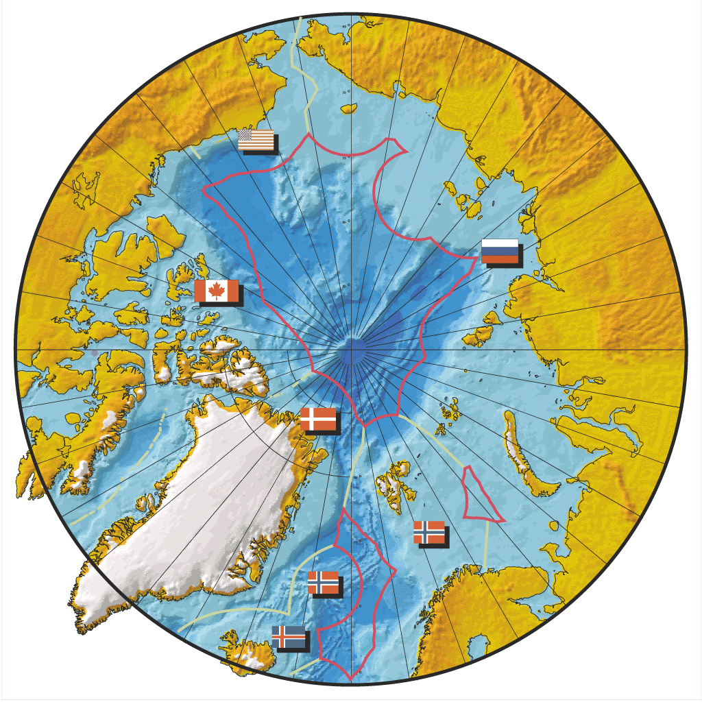
Figure 11. Approximate limits of the Exclusive Economic Zones (EEZ's) of the Arctic coastal states, illustrating a proposed scheme for partitioning the project. Bilateral limits are shown in green, High Seas limits in pink. Each coastal state would assume responsibility for managing the compilation of public-domain and proprietary bathymetry within its own EEZ. Contiguous states would assume a cooperative responsibility for compiling public-domain data in each of the three High Seas Zones. (Macnab) |